Gbbis's data & Partners
Demographic Data Where You Need It
Every data point is a step towards informed decision making with Gbbis’s Data
Demographics solutions.

Demographic data:
up-to-date and accurate
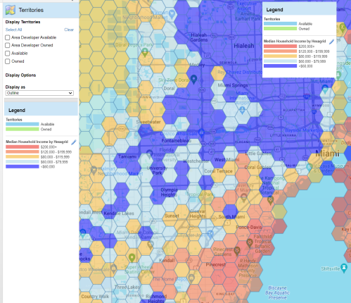
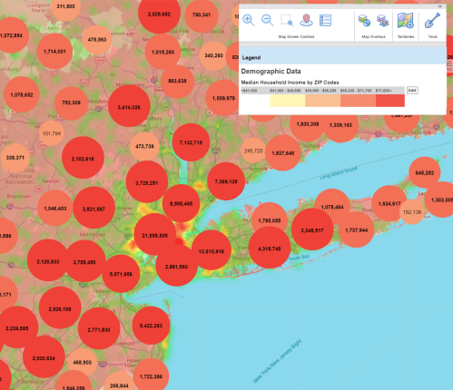
At Gbbis, we offer a spectrum of over 20,000+ demographic variables sourced from leading providers, ensuring a reservoir of accurate and up-to-date data at your fingertips.
Our journey with you is about crafting custom solutions, sometimes even pioneering technology to ensure your demographic data visualization aligns seamlessly with your business objectives.

Demographic data spectrum
Our territory creation service focuses on profitability through:
Current Year Demographics:
Engage with a snapshot of the present demographic landscape.
5 Year Projections:
Step into the future with demographic projections, preparing you for the market dynamics of tomorrow.
Census Data by ZIP code:
Dive into a comprehensive repository of census data, unveiling the demographic narrative of your market landscape.
Your Lens to Market Dynamics
Customer Demographics & Their Variables
Explore a plethora of demographic variables covering facets like Population, Households, Income, Labor Force, Dwellings, Household Assets, Origin & Ancestry, and Ownership Costs.
Population
Population by age, household, race, sex and more.
Households
Types, age, size, language and more.
Income
Averages and medians, family income, household income and more.
Labor Force
Employment status, by industry, by occupation and more.
Dwellings
Value, units, rent, year built and more.
Household Income
By age, median and averages by age.
Household Assets
Employment status, by industry, by occupation and more.
Origin & Ancestry
Asian, Indian, American, Scandinavian and more.
Ownership Costs
Monthly occupancy costs, dwelling value, by race and more
Ownership Costs
Monthly occupancy costs, dwelling value, by race and more
Understanding the Consumer Pulse
Lifestyle / Behavioral Data
Profiling Data to connect neighborhood demographics with consumer preferences and attitudes.
Consumer Expenditure
Apparel, gifts, health care, utilities and more.
Religion & Political Data
Psychographics, religion, political outlook and more.
AGS Panorama Profiling Data
Connecting neighborhood with demographics, consumer preferences and attitudes.
Navigating the Risk Landscape
Risk Indices / Risk Variables
Equip yourself with insights into Weather Risks and Crime Risks, ensuring a comprehensive understanding of the risk variables that could influence your market strategy.
Weather Risk
Temperature, precipitation, degree days, air pollution and more.
Crime Risk
Assault, robbery, burglary and more
Delving Deeper
Neighborhood Segmentation
Engage with Neighborhood Demographics and Consumer Behavior insights covering a spectrum of sectors like Automotive, Insurance, Leisure, Vacation, and Travel.
Neighborhood Demographics
Household, population and more
Consumer Behavior
Automotive, insurance, leisure, vacation, travel and more
Ready to transform your demographic data into a fountain of actionable insights?
Gbbis’ comprehensive suite of demographic reports can help you.